
Lands commission commits sh6b to title government land, block encroachers
The government seeks to protect government property from widespread encroachment, fraud and ownership disputes. The entire programme is expected to cost sh100b.
Harriet Ntabazi, the State Minister for lands addressing journalists during a press conference at the Uganda Media Centre on July 3, 2026. (Photos by Nancy Nanyonga)
________________
The government has allocated sh6b this financial year to identify, survey, title and digitally register all public land in Uganda.
The government seeks to protect government property from widespread encroachment, fraud and ownership disputes. The entire programme is expected to cost sh100b.
Officials say nearly three-quarters of government-owned land remains untitled, leaving schools, hospitals, roads, forests, wetlands, police stations and other public assets exposed to illegal occupation and competing ownership claims.
According to the Uganda Land Commission (ULC), government land accounts for about 23% of Uganda's total land area, but only 26.16% of it has been formally titled, meaning approximately 74% lacks legal documentation.
ULC Secretary Andrew Nyumba said the nationwide exercise is expected to be completed within five years, although implementation will be phased because of limited funding.
"The programme was initially estimated to cost about sh100b, but only sh6b has been provided in the current financial year," Nyumba confirmed.
He explained that the first phase will focus on cities, municipalities and other urban centres, where government land is under the greatest pressure from rapid development and illegal occupation.
He said the programme is intended to address the growing number of cases involving fraudulent land titles, illegal occupation and conflicting ownership claims over public land.
Nyumba acknowledged that previous efforts had been slowed by inadequate funding, limited public awareness of land laws and resistance from some communities.
"Land matters are sensitive," he said, noting that some communities have questioned why the exercise is being undertaken now. He attributed the renewed effort to increased political commitment to safeguard public assets.
The state minister for lands, Harriet Ntabazi, said many government institutions occupy land that was acquired decades ago through community donations, compulsory acquisition or administrative allocation before modern land registration systems were introduced.
(L-R) Andrew Nyumba Secretary Uganda Land Commission, Harriet Ntabazi State Minister for lands, Tom John Fisher Kasenge Commissioner Uganda Land Commission, Denis Musinguzi Principal land officer Uganda Land Commission and Henry Opyene Communication officer Ministry of lands pose for a group photo after addressing journalists at the Uganda Media Centre on July 3, 2026. 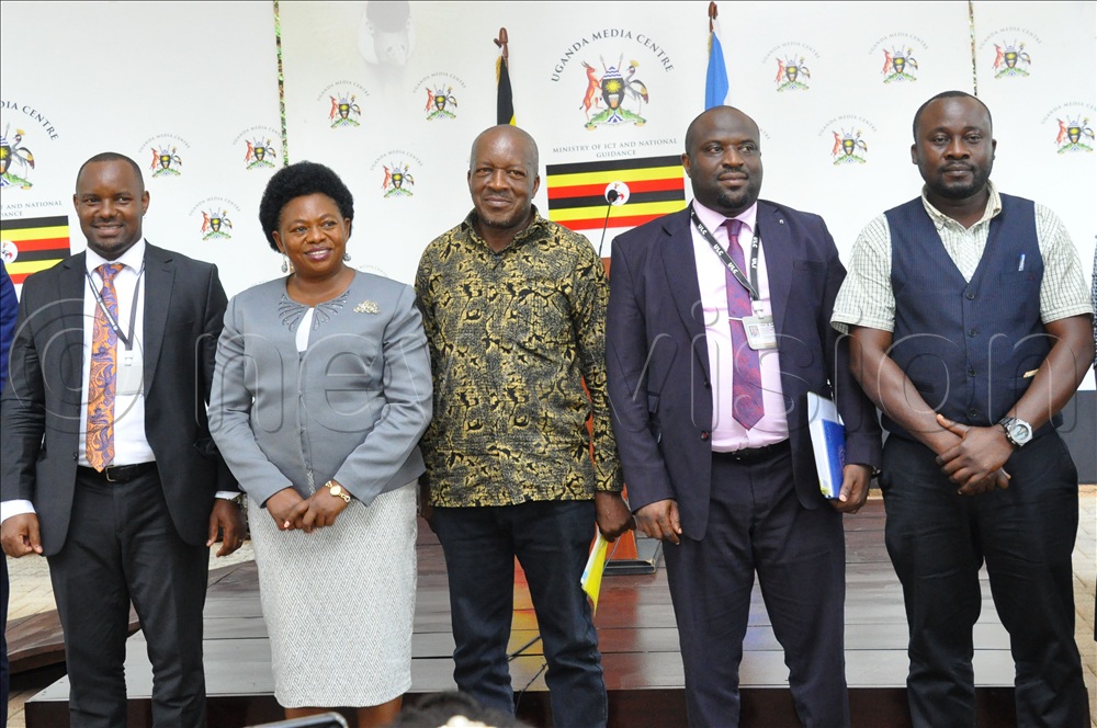
Because much of the land was never formally surveyed or titled, she said, property boundaries have become unclear, making public land vulnerable to encroachment and lengthy court disputes.
She said the Comprehensive Government Land Inventory will, for the first time, establish a verified national database of all government land. Every parcel will be surveyed, legally verified and digitally mapped before being integrated into the National Land Information System.
According to the minister, the inventory will capture each property's location, size, legal status, occupancy, level of development and whether it is affected by encroachment, disputes or other risks.
The information will also support government planning for infrastructure development, education, healthcare, security, environmental conservation and investment.
Ntabazi noted that the exercise will not involve compulsory acquisition of private land or interfere with legally owned private property.
Instead, she said, the programme is solely intended to identify, document and protect land that already belongs to the government or is held in trust for the people of Uganda.
Implementation will begin with government institutions compiling existing land records. This will be followed by field verification by multidisciplinary teams comprising surveyors, land officers and physical planners.
Ntabazi said local leaders, neighbouring landowners and community representatives will participate in verifying historical land information to minimise disputes and improve the accuracy of records.
The Uganda Land Commission will coordinate the programme in partnership with the Ministry of Lands, Housing and Urban Development; district land offices; local governments; and other ministries, departments and agencies - all of which will be required to identify and account for land under their control. End.