
Nile Bank Forest project to boost livelihoods along River Nile
The project, implemented by the Ministry of Water and Environment and funded by the Government of Uganda, targets forest reserves bordering the River Nile to protect the catchment, prevent siltation and restore degraded areas. The focus is now on the 606-hectare Nile Bank Central Forest Reserve in Butagaya sub-county, Jinja district, after earlier work on Namavundu Central Forest Reserve.
Some of the trees in the Nile Bank Forest Reserve in Butagaya Sub-County in Jinja district. (Credit: Donald Kiirya)
JINJA - Communities living adjacent to the Nile Bank Central Forest Reserve are set to benefit directly from the Kalagala and Itanda Falls Conservation and Protection (KIFCP) Project through beekeeping, tree planting and paid restoration work, as the Government moves to reopen the reserve boundaries.
The project, implemented by the Ministry of Water and Environment and funded by the Government of Uganda, targets forest reserves bordering the River Nile to protect the catchment, prevent siltation and restore degraded areas. The focus is now on the 606-hectare Nile Bank Central Forest Reserve in Butagaya sub-county, Jinja district, after earlier work on Namavundu Central Forest Reserve.
The Forestry Technical Person at the Ministry of Water and Environment, William Mawenu, said the reserve is critical to the health of the Nile.
"We are here at Butagaya sub-county headquarters in line with the Kalagala and Itanda Falls Conservation and Protection Project, and this project is basically looking at opening the boundaries of forest reserves that border the River Nile," Mawenu said at Butagaya sub-county headquarters in Jinja on October 22.
He further noted, "These reserves are very important because they form part of the broader catchment of the Nile and any activities like agriculture that are along the boundary of the Nile cause siltation and compromise the ecosystem of our river. So, this project has prioritised opening the boundaries of these reserves and, in this case, we are handling the Nile Bank Central Forest Reserve.
Mawenu emphasised that the exercise is collaborative and not an eviction.
"I want to assure members of the public that we are not here to do evictions. This is not an eviction exercise—we want to engage the elderly people, who have known the boundaries of these reserves because they have been here for long. They know where the original landmarks and the mark stones exist. Then, we compare the information that we are getting from the ground and from the individuals with what we have on our boundary maps," he said.
Mawenu noted that the move is aimed at preventing conflicts that arise between the community and government. "So, when they do the exercise, communities are able to live in harmony, forests remain intact, we minimise encroachment, and this is being done for the benefit of the current and future generation," he stated.
According to Mawenu, the Ministry of Water and Environment will work with historicals and existing maps dating back to the 1940s-1960s to confirm boundaries, adding that the ministry has put in place formal grievance handling structures.
The project, he noted, has also developed a document that helps in handling how grievances and conflicts are addressed. "The issues that can be raised could be issues that are concerning the environment, but they could also be social issues," Mawenu said, adding that police and district structures were formally engaged.
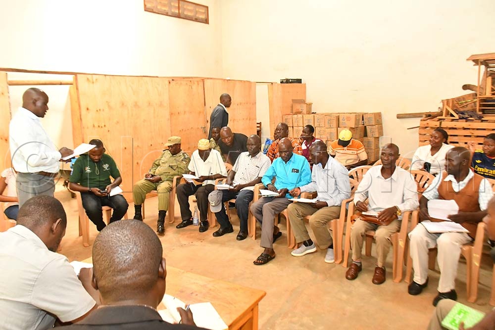
Officials from the Ministry of Water and Environment meeting with local leaders at Butagaya sub-county headquarters in Jinja district. (Credit: Donald Kiirya)
"We've engaged the Regional Police Commander, District Police Commander, and the other police institutions. These people were informed formally. They were written to, not by word of mouth. So, we are not here through an informal arrangement," he said.
The Senior Forest Officer at the Ministry, Michael Kusuro, said the project is deliberately designed to support livelihoods of adjacent communities.
"As far as the project is concerned, local communities that live adjacent to this forest reserve are going to benefit a lot. The project intends to support the livelihoods of the local communities that live adjacent to the forest reserve. We have what is called collaborative forest management," Kusuro said.
He said there are already three groups that they have formed, and they intend to supply them with some seedlings, basically indigenous tree seedlings for planting, and that when those trees grow, they expect them to become sites for beehives.
"Remember, a jerrycan of honey is worth between sh200,000 and sh500,000. If these communities harvest around 100 jerrycans, that is a lot of money for our local communities. It can even help them pay school fees for their kids," Kusuro said.
The boundary reopening, Kusuro noted, will also create direct employment and restore the riverbank.
"We are here to inform the Butagaya sub-county leaders that the Ministry of Water and Environment is going to start re-opening the forest boundary of the Nile Bank Central Forest Reserve. It is part of our management activity. When infrastructure has disappeared, we normally replant these boundaries with pillars," he said.
He listed villages bordering the reserve that will be engaged: Lumuli B, Lumuli A, Itanda Village, Bubugo Central and Bubugo-Bugobi Village.
"We shall do some bit of restoration of the degraded forest reserve, most especially along the riverbanks with the bamboo, with the natural trees like Muvule, Musizi; there is also Mugave. We intend to plant along the riverbank so that it holds the soil from falling and eventually causing siltation of the river and then affecting the dams. So that is an opportunity for our people," Kusuro said.
Kusuro further said that they will employ and use the local communities adjacent to the forest. They will regroup some of them to keep maintaining those planted trees and even trees along the boundary line. He said the exercise will also clarify illegal titles.
"This exercise of boundary opening is going to help the Government establish who has processed an illegal land title inside the forest reserve or one who has processed a title next to the boundary line," he said.
Derrick Egunyu, a surveyor with the Ministry, explained the technical process: "The first stage is stakeholder engagement, and we started from the district where we engaged the different leaders: Chief Administrative Officers and Resident District Commissioners. Then, the next process is talking to the sub-county leaders, and then the Local Council 1 (LC1) chairpersons and the councillors, which we are doing right now.
Egunyu said that after stakeholder engagement, they will have the reconnaissance, which is a key factor where they will engage with the community, LC1 chairpersons and the elders so that they can show Ministry officials what has been maintained and the existing milestones
"This forest reserve that we are talking about is about 606 hectares. The reserve has a boundary that is natural, which is the River Nile, and then also a part of the line, which we call a cut line of about 12 kilometres, which borders the people," Egunyu said, adding, "These maps were drawn in 1968. They have dimensions and bearings that were used to demarcate the boundaries. So, what we are doing is a boundary opening just to replace the missing marks."
He said communities will be involved in line cutting and pillar planting. "During the reconnaissance exercise, we are going to move through the 12 kilometres, picking points of those corners with the different LC chairpersons and the elders. After picking those points, we are going to overlay those points on these maps," he said.
Egunyu added, "We shall involve the district surveyor before we do any work. We shall do this analysis of the data together. We work with integrity and professionalism. So, we don't want a community worried that we're going to grab their land. What is on the map is what is implemented on the ground."
Butagaya sub-county chairperson Tanansi Waiswa thanked the ministry for engaging local leaders.